At some point in that vast, soggy bowl where the river Avon rises, my two ghostly companions found themselves walking circles in the mist. They were not the first or the last to blame their misfortune on the supernatural, or some other beyond-us power: “Indeed so frequently has it happened that the country folk of Devonshire call it being pixie-led.”
I wasn’t carrying an adder skin, the customary Dartmoor charm used to break a pixie’s spell, but I did have better weather as I tried to retrace their footsteps. Heat rippled in the middle distance as I approached the ruined tin mine at Eylesbarrow, an accidental waymark on the way to Princetown for the pixie-led Victorians, and only recently abandoned when they were here in 1864.
A handwritten record of their walk survives in the West Country Studies Library; the writer, most likely from Exeter, is anonymous, signing himself only as BA, while his companion, Tom Steppitt, is almost certainly pseudonymous. They had started from South Brent, then a stopping point on the newly opened South Devon Railway. Trains no longer stop but the platforms and the station buildings survive, waiting for their time to come again. The pair had forgotten to pack a compass, had only one mackintosh between them, and carried an unfashionably large supply of tobacco. It is difficult not to warm to them.
As I followed their footsteps up the Avon valley it was easy to think they would have recognised the contemporary sights and sounds, if you imagine-out the hum of traffic from the A-38, the 1950s-vintage dam and reservoir, and the criss-cross of vapour trails high above you. Those hieroglyphic reminders of the climate crisis were a constant overhead companion on my pre-pandemic journey, much reduced during our worrisome year of lockdowns and not straying too far from home. How soon, I wonder, before the vapour trails return?
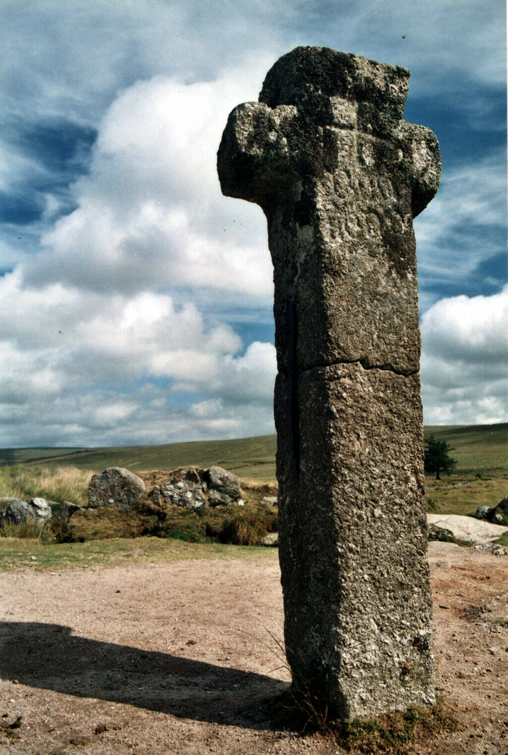
The compass-less walkers were given directions to Princetown at Eyelesbarrow, which took them past the recently vandalised Nun’s Cross, prompting in the account of their walk a full dose of Victoriana: “I might remark that granite crosses such as this for instance, are far from infrequent in the two westernmost counties, and they are undoubtedly some of the most ancient ecclesiastical remains in England and at one time must have been very numerous. Hoary, weatherworn, and alas too, ill-treated monuments they are, but many of them have braved, successfully, the Battle of the Breeze for well nigh a thousand years.”
Princetown failed to impress. Even the “perpetual cracking of the landrail, or corncrake as he is called” did not dispel their sense of dreariness, a feeling that, alas, remains. The rasp of the corncrake, like a slightly too-fast socket spanner, isn’t part of the backing track any more. What was possibly the last corncrake to have been seen in the national park was a bird rescued from a cat, at Scorriton in 1990. Spring and autumn migrants are heard very occasionally, heading to or from the Hebrides and Orkney, their only remaining UK breeding grounds. Some corncrakes driven from a cornfield near Chagford, in 1948, may have been the last to have bred on Dartmoor. Three years before our two Victorians had witnessed that perpetual cracking, a shooting party at Marlborough, not far away in the South Hams, bagged 84 of the birds.
The pair saw “trout darting about in great plenty” in the river Avon, a plenty which now eludes us, and they were delighted to find royal ferns beside the river Teign, a plant collected almost to extinction in their own time, and now a rarity, struggling everywhere to maintain a toehold as suitable habitat is lost. There was traffic on the roads and an occasional scatter of litter – I was never too far from litter, even in the most remote places – as I made my way from Princetown to Great Mis Tor, a “place of cyclopean masonry and Druids”, at the start of the second day. Resting at the top I wondered whether we are today so very different from the shootists of Marlborough? Or are we simply pulling different triggers?
Then the weary trudge to Fir Tor and Cranmere Pool across “podgy peat hillocks”. Were they describing the sea of tussocks formed by purple moor grass, or drunken charlie grass as it is sometimes called? I stumbled on into the army ranges, occasionally tripping on the tussocks, like the eponymous drunken charlie, promising myself never to repeat this particular part of the walk. At Cranmere Pool two walkers were busy consulting their satnav – the modern equivalent of being pixie-led I wondered in a smug kind of way, having got there using map and compass. I left behind a postcard in the famous letterbox, which arrived home a day after I did. My predecessors “placidly smoked a genial pipe” before ticking off landmarks on the way to Lydford (still Lidford in 1864, the name later changed by the coming of the railway): Great Kneeset, Watern Oak, Ger Tor, Hare Tor.
I departed from their route on the third day, following the old railway to Sourton, rather than risk the traffic on the A-386. Strange to think the line had been built, operated, closed and dismantled since they made their trip. Sourton is not as quiet and lonely now as they described, you don’t quite recapture the feeling until further along their route: Homerton Hill, Black Tor, Yes Tor. But the description of the view from Yes Tor does stand the test of time: “Southward the eye ranges over a weird waste of moor, the wild table land of Cranmere, and the distant heights of Fir Tor and Mis Tor. To the east lies Cawsand Beacon, a vast round hill. Of less altitude than the peak itself by but 50 feet, immediately in front of you, rises the rock-piled summit of High Willhays which you think must be loftier than the tor on which you stand. North and west the eye rests for a while on a cultivated and more civilised prospect as it passes on to the misty confines of north Devon and Cornwall.” They were right about High Willhays, it is indeed a few feet higher; the misnamed Cawsand Beacon is Cosdon on modern maps.
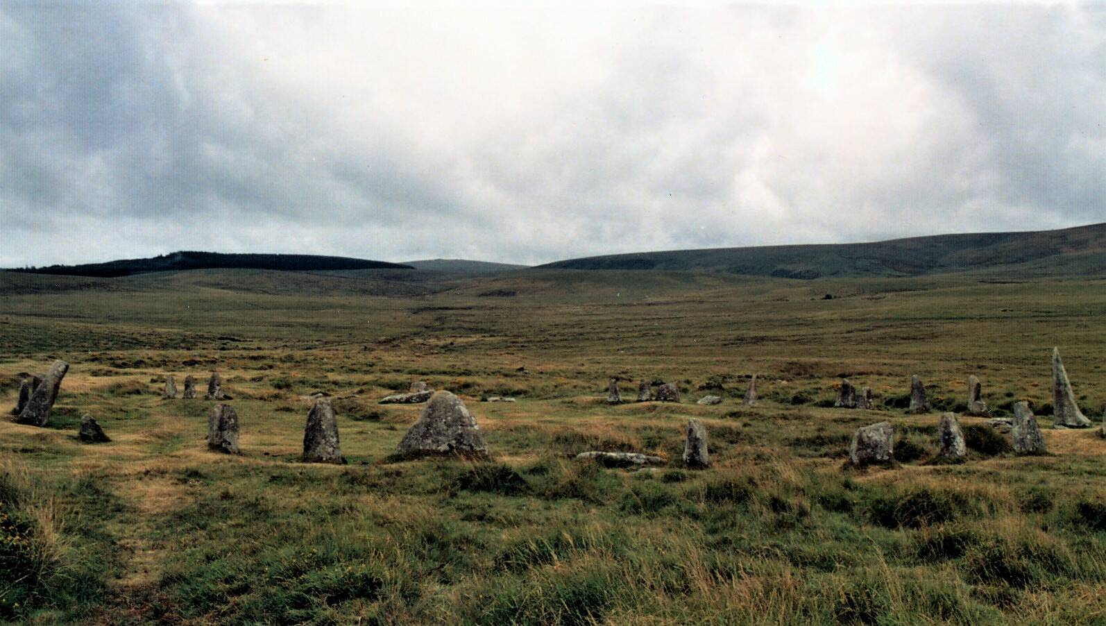
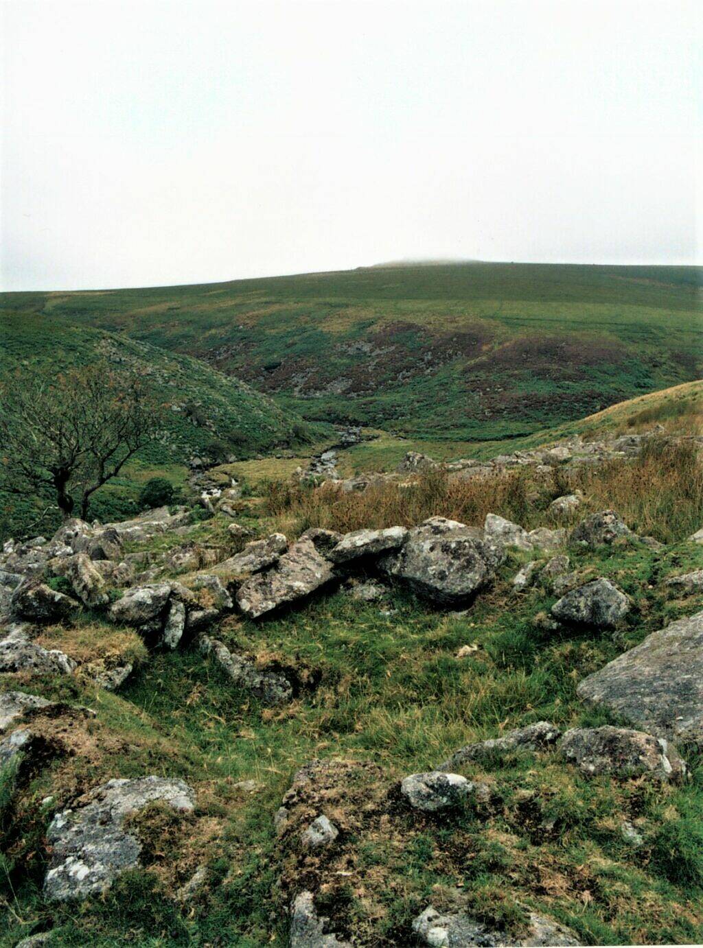
Army range roads now criss-cross this part of Dartmoor, making for easier walking to East Mill Tor and then Steeperton Tor. But it had still been a long day, with heavy rain early on and sunshine in the afternoon, and my legs were beginning to tire. The two Victorians wheeled out Druids once again as they passed Scorhill stone circle – indeed, they would later describe the Neolithic burial chamber at Spinster’s Rock as a “fine old Druidical remain”, and Drewsteignton “Druid’s Town”. They were unhappy not to find a house “in the public way” at Gidleigh and trudged thirstily to Chagford. I trudged thirstily along the same lanes too and, after three days walking, found it easy to sympathise with them.
I ended my journey at Chagford, they carried on to Exeter, which they reached in a single day. At Fingle Bridge they had found “two picnics going on at once to the tune of a hideous German band” and to say goodbye to them I climbed to Prestonbury hill fort, an Iron Age rampart high above the then as now tourist honeypot. It seemed as good a place as any to look back at the last three days, to dwell on the changes that had and hadn’t occurred since my two by now slightly less ghostly companions had passed this way, and to think about the passage of time.
(An earlier version of this article first appeared in Dartmoor Matters, the newsletter of the Dartmoor Preservation Association. I revised it during the recent lockdown, for want of something better to do. A Gentleman’s Walking Tour of Dartmoor 1864, was published by Devon Books in 1986 and is still available in libraries and often to be found in second hand bookshops.)